
The Cariboo Mountains come into view as the road passes Cameron Ridge and descends by Cameron Creek. (Richard McGuire Photo)
This is Part 3 about my trip to British Columbia’s interior temperate rainforest and the Cariboo region. See also Part 1 and Part 2.
I had read about a back road across wilder areas of the Cariboo region and up into historic mining town Barkerville’s back door.
I wanted to include it on my trip through the Cariboo, but there were logistical challenges. I was towing a small eggshell trailer and I was nervous about dragging it down unknown logging roads for hundreds of kilometres. It made more sense to visit Barkerville by the front door, Highway 26 from Quesnel.
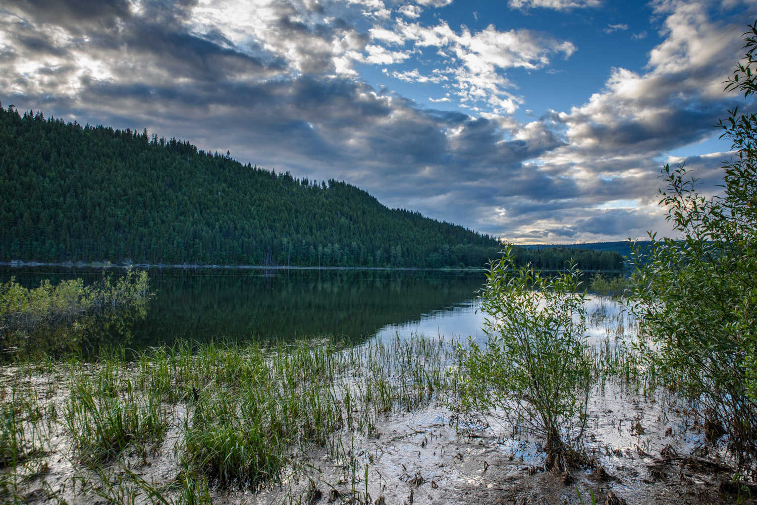
I still thought about doing part of the back-road journey without the trailer as a day trip. So I camped two nights at Cedar Point Provincial Park south of Likely. And on the second day I set out along logging roads by the back-road route to Ghost Lake, a recreation site on the edge of Cariboo Mountains Provincial Park. It’s noted for dramatic waterfalls as the Matthew River tumbles out of Ghost Lake and makes its way to the Cariboo River.
The verdict: It was very good by logging road standards, but there were parts where I was glad that I wasn’t towing a trailer. You can probably make it fine with a two-wheel drive if you check conditions beforehand and take it slow. In most places it’s wide enough for two vehicles to pass, but some areas are narrow and rough. I was glad to have 4X4.
For me the trip was worth it, to be able to explore the Cariboo away from the highways. But it’s a long journey and there are large stretches where any views end at the trees.
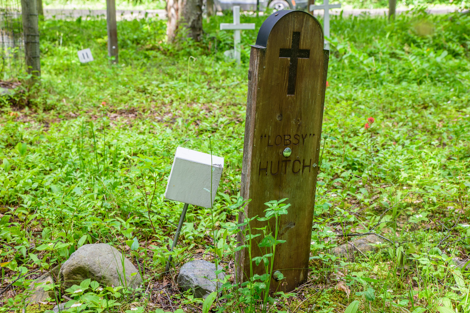
I stopped at Keithley Creek to visit the pioneer cemetery, which was established in 1881, 21 years after William “Doc” Keithley struck gold nearby. There were little write-ups tacked up and weathered, about some of the people buried there.
One of the tragic stories was that of Ada “Lobsy” Margaret (nee Hutch) Popp. She died at age 18 in 1931 of strychnine poisoning in a suicide. She was married two years earlier to a man, Popp, who mistreated her. Her father brought her home, but two or three weeks later, she took the poison when her parents were outside working. Lobsy’s sister also died in her teens and her brother was killed in the World War II invasion of Normandy.
I backtracked a little to cross the Cariboo River as the road followed the south shore of Cariboo Lake before heading into the mountains.
As discussed in the first part of this series, this is a unique interior temperate rainforest. It rained on some of the drive and was mostly cloudy throughout, but the forests were a lush green and the streams were flush with water.
Throughout the trip you are teased with glimpses of the Cariboo Mountains only to lose them as you drive through coniferous forests amid volcanic rock formations.
Crossing over Cameron Ridge and descending by Cameron Creek, the glimpses of the mountains were becoming more frequent.
Some areas were clear-cut logged, which perversely opened up views of the mountains.
The Matthew River Falls were a good point to turn around and head back the way I came – after checking out the falls and Ghost Lake, of course. At this point, it was raining.
On the trip I had four black bear sightings, one on the road ahead of me as I turned a corner. All wanted nothing to do with me and headed into the woods before I could see much.
The road certainly wasn’t busy, but I did encounter other traffic fairly often – both recreational and industrial.
I returned to Cedar Point Provincial Park and got ready to head south the next morning for the final stage of my journey – the Upper Fraser River.


To the northeast of Likely, on the way to Keithley Creek, the route crosses to the north side of the Cariboo River (Richard McGuire Photo)

Approaching Keithley Creek, you pass along the north shore of Cariboo Lake. (Richard McGuire Photo)

Keithley Creek was established by American William “Doc” Keithey when they struck gold in 1860. This cemetery was established more than two decades later. Grave markers have been restored, and a local society has left weathered accounts of the lives and deaths of some of those buried there. (Richard McGuire Photo)

One of the tragic stories posted at Keithley Creek Cemetery is that of Ada ‘Lobsy’ Margaret (nee Hutch) Popp. She died at age 18 in 1931 of strychnine poisoning in a suicide. She was married two years earlier to a man, Popp, who mistreated her. Her father brought her home, but two or three weeks later, she took the poison when her parents were outside working. Lobsy’s sister also died in her teens and her brother was killed in the World War II invasion of Normandy. (Richard McGuire Photo)

On the south shore of Cariboo Lake there is basic camping at Ladies Creek Recreation Site. Looking up to the end of the lake, the mountains are now visible. (Richard McGuire Photo)

The road climbs through forest past Mount Barker toward Three Ladies Mountain. Streams like this one are flush with water from this interior rainforest. (Richard McGuire Photo)

I’m used to encountering cattle and deer on the road, but this was different, A black bear was standing there as I turned a corner on a logging road near Maeford Lake to the northeast of Likely, B.C. (Richard McGuire Photo)

Rocky crags like this, no doubt formed with volcanic rock, are a common feature along the route as it passes by Maeford Lake. (Richard McGuire Photo)

The Cariboo Mountains come into view as the road passes Cameron Ridge and descends by Cameron Creek. (Richard McGuire Photo)

The Cariboo Mountains come into view as the road passes Cameron Ridge and descends by Cameron Creek. (Richard McGuire Photo)

The Cariboo Mountains come into view as the road passes Cameron Ridge and descends by Cameron Creek. (Richard McGuire Photo)

The Cariboo Mountains come into view as the road passes Cameron Ridge and descends by Cameron Creek. (Richard McGuire Photo)

The Matthew River tumbles out of Ghost Lake over a series of dramatic waterfalls. It continues northwest, flowing into the Cariboo River. (Richard McGuire Photo)

The Matthew River tumbles out of Ghost Lake over a series of dramatic waterfalls. It continues northwest, flowing into the Cariboo River. (Richard McGuire Photo)

The Matthew River tumbles out of Ghost Lake over a series of dramatic waterfalls. It continues northwest, flowing into the Cariboo River. (Richard McGuire Photo)

There is recreation site at Ghost Lake on the edge of Cariboo Mountains Provincial Park. (Richard McGuire Photo)

I camped two nights at Cedar Point Provincial Park, south of Likely, while I explored the Cariboo. This is the view from my campsite. Too bad about the mosquitoes. (Richard McGuire Photo)

I left my Triple E Surf-Side eggshell trailer back in camp while I toured the back road. (Richard McGuire Photo)