5. Double rainbow at Chasm Provincial Park – ‘What does it meeeeaaaannnn?’

I arrived at Chasm Provincial Park just in time for evening golden light. I’d driven out of a rainstorm near Williams Lake, but still wasn’t counting on the double rainbow that appeared. What does it meeeaaan? (Richard McGuire Photo)

This is Part 5 about my trip to British Columbia’s interior temperate rainforest and the Cariboo region in June. See also Part 1, Part 2, Part 3, and Part 4.

I had aimed my arrival at Chasm Provincial Park to coincide with “golden hour,” that time before sunset when the low-angled sun turns to orange.

I watched the shadows move across the sharp cliffs as the sun lowered.

I’d just driven from a rainstorm to the north near Williams Lake – Chasm is just north of Clinton. I was lit with bright sun as the storm abated, but dark clouds hung in the distance.

Suddenly, as remnants of the storm drifted past me, a rainbow appeared over the cliffs. Soon I could see the double.

But ever since the “double rainbow guy” meme of 2010, all I can think of when I see a double rainbow is that guy, who was overwhelmed by the double rainbow he saw it. He sounded like he was tripping on acid, but he might just have been mesmerized by its beauty. Double Rainbow Guy, aka Yosemitebear62, has had well over 46 million views of his shaky YouTube video.

The Painted Chasm is impressive in itself even without the double rainbow, though I would reject the comparisons some make with the Grand Canyon – it’s on a much, much smaller scale and its formation was entirely different.

The chasm is said to have been forming for more than 16 million years, especially during lava flows around 10 million years ago that created basalt formations. It was later shaped by glacier flow during the much more recent ice age.

I only observed the chasm, a steep, rocky valley, from the observation areas at the top. There are limited hiking opportunities, but much of the park is inaccessible.

The double rainbow made a fitting end to my trip around Central B.C. I was up early the following day to drive back to Osoyoos.

I arrived at Chasm Provincial Park just in time for evening golden light. I’d driven out of a rainstorm near Williams Lake, but still wasn’t counting on the double rainbow that appeared. (Richard McGuire Photo)

I arrived at Chasm Provincial Park just in time for evening golden light. I’d driven out of a rainstorm near Williams Lake, but still wasn’t counting on the double rainbow that appeared. (Richard McGuire Photo)

I arrived at Chasm Provincial Park just in time for evening golden light. I’d driven out of a rainstorm near Williams Lake, but still wasn’t counting on the double rainbow that appeared. (Richard McGuire Photo)

I arrived at Chasm Provincial Park just in time for evening golden light. I’d driven out of a rainstorm near Williams Lake, but still wasn’t counting on the double rainbow that appeared. What does it meeeaaan? (Richard McGuire Photo)

I arrived at Chasm Provincial Park just in time for evening golden light. I’d driven out of a rainstorm near Williams Lake, but still wasn’t counting on the double rainbow that appeared. What does it meeeaaan? (Richard McGuire Photo)

Up the less seen Fraser River Valley

The mighty Fraser River appears into full view as you reach the end of Big Bar Ferry Road. (Richard McGuire Photo)

This is Part 4 about my trip to British Columbia’s interior temperate rainforest and the Cariboo region. See also Part 1, Part 2 and Part 3.

When most people think of the Fraser Valley, they think of the wide plain stretching between Hope and Vancouver.

Or perhaps they think of the Fraser Canyon where the mighty river flows through a gorge between Lillooet and Hope.

My trip in June through Central B.C. took me through other Fraser Valleys on the river’s long journey from its headwaters near Mount Robson, northwest up the Rocky Mountain Trench, and south from Prince George past Quesnel and down to Lillooet.

For the last part of my trip, I drove south from William’s Lake to Clinton and continued southwest to Downing Provincial Park on Kelly Lake where I camped two nights.

From there, I took several excursions.

On the first evening, I took the rough and narrow Pavilion-Clinton Road up a series of wooded hairpins to a plateau where cattle grazed. As I got closer to Pavilion, a First Nations community, the wooded landscape gave way to dry valley slopes covered in sagebrush, not unlike the landscape around Osoyoos.

It was a rough road, and not wishing to return the same way, I opted to take Highways 99 and 97 back to Clinton, a much longer route than the journey over the mountain.

The second day was my Fraser adventure, following old dirt roads that paralleled the Fraser and emerged in its rugged valley, carved by millennia of water and glacier flow. It was just as common to see hoodoos as rocky crags.

The road followed some of the alternate routes of the gold rush years, passing through ranches and such First Nation communities as Canoe Creek, Dog Creek and Alkali Lake. Many of the log buildings dated back to the 19th century.

Much of the country was wide and open and sparsely populated, but scenic nonetheless.

It was a drizzly and overcast day, but the clouds didn’t really open up until I passed Alkali Lake. By Williams Lake, the sun was shining again, and the storm passed over.

I retraced my route down Highway 97 from Williams Lake to Clinton, making a detour to Chasm Provincial Park just as the light was turning golden.

I’ll tell what happened there in my next and final installment.

Here’s my route on Google Maps.

I camped two nights at Downing Provincial Park at the end of Kelly Lake, southwest of Clinton, B.C. (Richard McGuire Photo)

I toon an evening drive up a steep mountain on the Pavilion-Clinton Road, arriving in cattle-grazing lands at the top. The road was narrow and rough, with occasional mud bogs on the roadway. (Richard McGuire Photo)

The landscape along the Pavilion-Clinton Road changes dramatically. As you get closer to Pavilion, the forests give way to sagebrush. (Richard McGuire Photo)

At the First Nations community of Pavilion, you descend to Highway 99. The trip back to Downing Lake Provincial Park is much longer by the highway route. (Richard McGuire Photo)

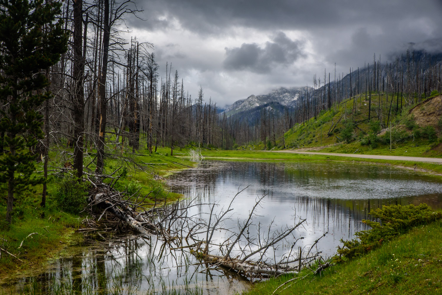
Traveling north on Jesmond Road from Downing Lake Provincial Park I passed a small pond. The weather was damp and drizzling. (Richard McGuire Photo)

Continuing up Jesmond Road, I passed this little cabin with moose antlers above the door. Judging by the undisturbed vegetation, it was vacant. (Richard McGuire Photo)

Circle H Mountain Lodge on Jesmond Road has a small stagecoach near its entrance. It’s one of several guest ranches catering to those who like the outdoors. (Richard McGuire Photo)

A log building stands by Jesmond Road. Judging by the doors, it looks like a work shed. (Richard McGuire Photo)

Jesmond was originally settled in 1870 and called Mountain House. It had a general store and post office. The post office and store are long gone, and now it’s Coldwell Ranch. (Richard McGuire Photo)

North of Jesmond, the Big Bar Ferry Road turns west and continues down to the Fraser River. The land is rocky. (Richard McGuire Photo)

North of Jesmond, the Big Bar Ferry Road turns west and continues down to the Fraser River. The land is rocky. (Richard McGuire Photo)

As you travel west on Big Bar Ferry Road, the forest gives way to drier sagebrush landscape. (Richard McGuire Photo)

Big Bar Ferry Road winds down a valley to the Fraser River. (Richard McGuire Photo)

A slope above Big Bar Ferry Road is covered with burned trees from a past forest fire. In the gullies, living trees are growing. (Richard McGuire Photo)

Dry rocky slopes line the valley as you approach the Fraser River on Big Bar Ferry Road. (Richard McGuire Photo)

Near the bottom of Big Bar Ferry Road, a dry streambed widens into a small canyon. (Richard McGuire Photo)

As Big Bar Ferry Road reaches the Fraser River, the dry landscape shows areas of green cultivated and irrigated fields. (Richard McGuire Photo)

Big Bar Ferry takes vehicles across the Fraser River. The ferry is a “reaction ferry,” meaning it is guided across the river by an overhead cable and its power is provided by the river’s current. (Richard McGuire Photo)

Big Bar Ferry takes vehicles across the Fraser River. The ferry is a “reaction ferry,” meaning it is guided across the river by an overhead cable and its power is provided by the river’s current. (Richard McGuire Photo)

North of Jesmond, the Big Bar Ferry Road turns west and continues down to the Fraser River. The land is rocky. (Richard McGuire Photo)

A log shed stands next to Big Bar Ferry Road near the intersection with Jesmond Road. (Richard McGuire Photo)

Continuing north up Big Bar Road, you pass though forests and meadows amidst mountains. (Richard McGuire Photo)

The OK Ranch on Big Bar Road was established in 1859 and is one of B.C.’s earliest ranches. It also served as a roadhouse in its early days. (Richard McGuire Photo)

The OK Ranch on Big Bar Road was established in 1859 and is one of B.C.’s earliest ranches. It also served as a roadhouse in its early days. (Richard McGuire Photo)

The rusty remains of an old car have found a resting place next to Poison Lake Rd. (Richard McGuire Photo)

The intersection of Poison Lake Road, Meadow Lake Road and Dog Creek-Canoe Creek Road could be a confusing spot without the help of this sign. R.S.E.S is Rosie Seymour Elementary School in Canoe Creek. (Richard McGuire Photo)

Dog Creek-Canoe Creek Road cuts through a gap between rock formations. (Richard McGuire Photo)

After passing the First Nations village of Canoe Creek, you pass this ridge, an esker formed by glaciers. (Richard McGuire Photo)

Shortly after Canoe Creek, you pass over a ridge and view the road ahead that descends to the Fraser River. (Richard McGuire Photo)

Shortly after Canoe Creek, you pass over a ridge and view the road ahead that descends to the Fraser River. (Richard McGuire Photo)

Shortly after Canoe Creek, you pass over a ridge and view the road ahead that descends to the Fraser River. (Richard McGuire Photo)

Dog Creek-Canoe Creek Road contiunes northward parallel to the Fraser River. (Richard McGuire Photo)

Dog Creek-Canoe Creek Road contiunes northward parallel to the Fraser River. (Richard McGuire Photo)

Gang Ranch Road descends to the Fraser River, crossing on the only bridge between Lilooet and Highway 20 from William’s Lake. To the west is the Chilcotin. (Richard McGuire Photo)

Hoodoos are visible in the Fraser River Valley as Dog Creek-Canoe Creek Road climbs out of the valley. (Richard McGuire Photo)

Hoodoos are visible in the Fraser River Valley as Dog Creek-Canoe Creek Road climbs out of the valley. (Richard McGuire Photo)

The Dog Creek Dome is a basalt escarpment visible on the climb to the First Nations village of Dog Creek. (Richard McGuire Photo)

I was photographing the landscape at an overlook above Fraser gorge when I startled this bighorn ewe. She sailed over a barbed wire fence like she’d done it before. This was near Dog Creek, BC.

The Fraser River when viewed from above is a vast feature of the landscape. It separates the Coast Mountains from the vast expanses of the Interior Plateau. The sandy valleys are the result of millennia of erosion. (Richard McGuire Photo)

A log barn at Alkali Lake Ranch sits by the road as it starts to rain. (Richard McGuire Photo)


Cariboo back road

The Cariboo Mountains come into view as the road passes Cameron Ridge and descends by Cameron Creek. (Richard McGuire Photo)

This is Part 3 about my trip to British Columbia’s interior temperate rainforest and the Cariboo region. See also Part 1 and Part 2.

I had read about a back road across wilder areas of the Cariboo region and up into historic mining town Barkerville’s back door.

I wanted to include it on my trip through the Cariboo, but there were logistical challenges. I was towing a small eggshell trailer and I was nervous about dragging it down unknown logging roads for hundreds of kilometres. It made more sense to visit Barkerville by the front door, Highway 26 from Quesnel.

I still thought about doing part of the back-road journey without the trailer as a day trip. So I camped two nights at Cedar Point Provincial Park south of Likely. And on the second day I set out along logging roads by the back-road route to Ghost Lake, a recreation site on the edge of Cariboo Mountains Provincial Park. It’s noted for dramatic waterfalls as the Matthew River tumbles out of Ghost Lake and makes its way to the Cariboo River.

The verdict: It was very good by logging road standards, but there were parts where I was glad that I wasn’t towing a trailer. You can probably make it fine with a two-wheel drive if you check conditions beforehand and take it slow. In most places it’s wide enough for two vehicles to pass, but some areas are narrow and rough. I was glad to have 4X4.

For me the trip was worth it, to be able to explore the Cariboo away from the highways. But it’s a long journey and there are large stretches where any views end at the trees.

I stopped at Keithley Creek to visit the pioneer cemetery, which was established in 1881, 21 years after William “Doc” Keithley struck gold nearby. There were little write-ups tacked up and weathered, about some of the people buried there.

One of the tragic stories was that of Ada “Lobsy” Margaret (nee Hutch) Popp. She died at age 18 in 1931 of strychnine poisoning in a suicide. She was married two years earlier to a man, Popp, who mistreated her. Her father brought her home, but two or three weeks later, she took the poison when her parents were outside working. Lobsy’s sister also died in her teens and her brother was killed in the World War II invasion of Normandy.

I backtracked a little to cross the Cariboo River as the road followed the south shore of Cariboo Lake before heading into the mountains.

As discussed in the first part of this series, this is a unique interior temperate rainforest. It rained on some of the drive and was mostly cloudy throughout, but the forests were a lush green and the streams were flush with water.

Throughout the trip you are teased with glimpses of the Cariboo Mountains only to lose them as you drive through coniferous forests amid volcanic rock formations.

Crossing over Cameron Ridge and descending by Cameron Creek, the glimpses of the mountains were becoming more frequent.

Some areas were clear-cut logged, which perversely opened up views of the mountains.

The Matthew River Falls were a good point to turn around and head back the way I came – after checking out the falls and Ghost Lake, of course. At this point, it was raining.

On the trip I had four black bear sightings, one on the road ahead of me as I turned a corner. All wanted nothing to do with me and headed into the woods before I could see much.

The road certainly wasn’t busy, but I did encounter other traffic fairly often – both recreational and industrial.

I returned to Cedar Point Provincial Park and got ready to head south the next morning for the final stage of my journey – the Upper Fraser River.

To the northeast of Likely, on the way to Keithley Creek, the route crosses to the north side of the Cariboo River (Richard McGuire Photo)

Approaching Keithley Creek, you pass along the north shore of Cariboo Lake. (Richard McGuire Photo)

Keithley Creek was established by American William “Doc” Keithey when they struck gold in 1860. This cemetery was established more than two decades later. Grave markers have been restored, and a local society has left weathered accounts of the lives and deaths of some of those buried there. (Richard McGuire Photo)

One of the tragic stories posted at Keithley Creek Cemetery is that of Ada ‘Lobsy’ Margaret (nee Hutch) Popp. She died at age 18 in 1931 of strychnine poisoning in a suicide. She was married two years earlier to a man, Popp, who mistreated her. Her father brought her home, but two or three weeks later, she took the poison when her parents were outside working. Lobsy’s sister also died in her teens and her brother was killed in the World War II invasion of Normandy. (Richard McGuire Photo)

On the south shore of Cariboo Lake there is basic camping at Ladies Creek Recreation Site. Looking up to the end of the lake, the mountains are now visible. (Richard McGuire Photo)

The road climbs through forest past Mount Barker toward Three Ladies Mountain. Streams like this one are flush with water from this interior rainforest. (Richard McGuire Photo)

I’m used to encountering cattle and deer on the road, but this was different, A black bear was standing there as I turned a corner on a logging road near Maeford Lake to the northeast of Likely, B.C. (Richard McGuire Photo)

Rocky crags like this, no doubt formed with volcanic rock, are a common feature along the route as it passes by Maeford Lake. (Richard McGuire Photo)

The Cariboo Mountains come into view as the road passes Cameron Ridge and descends by Cameron Creek. (Richard McGuire Photo)

The Cariboo Mountains come into view as the road passes Cameron Ridge and descends by Cameron Creek. (Richard McGuire Photo)

The Cariboo Mountains come into view as the road passes Cameron Ridge and descends by Cameron Creek. (Richard McGuire Photo)

The Cariboo Mountains come into view as the road passes Cameron Ridge and descends by Cameron Creek. (Richard McGuire Photo)

The Matthew River tumbles out of Ghost Lake over a series of dramatic waterfalls. It continues northwest, flowing into the Cariboo River. (Richard McGuire Photo)

The Matthew River tumbles out of Ghost Lake over a series of dramatic waterfalls. It continues northwest, flowing into the Cariboo River. (Richard McGuire Photo)

The Matthew River tumbles out of Ghost Lake over a series of dramatic waterfalls. It continues northwest, flowing into the Cariboo River. (Richard McGuire Photo)

There is recreation site at Ghost Lake on the edge of Cariboo Mountains Provincial Park. (Richard McGuire Photo)

I camped two nights at Cedar Point Provincial Park, south of Likely, while I explored the Cariboo. This is the view from my campsite. Too bad about the mosquitoes. (Richard McGuire Photo)

I left my Triple E Surf-Side eggshell trailer back in camp while I toured the back road. (Richard McGuire Photo)


Travels in Central B.C. Part 2 – The Gold Rush Trail

A coach makes its way down the streets of Barkerville pulled by Belgian and Percheron horses. Barkerville, the scene of B.C.’s gold rush starting in the 1860s, has been reconstructed and brought back to life. (Richard McGuire Photo)

The British Columbia gold rushes that started at the end of the 1850s and boomed throughout the 1860s played a major role in opening up the B.C. Interior and its transportation routes.

On the second part of my trip to Central B.C. in late June, I explored some of the routes traveled by gold prospectors and miners around the upper Fraser Valley and beyond.

I visited several old mining communities, the most noteworthy of which were Quesnel Forks and Barkerville.

Quesnel Forks, near the present community of Likely, was established in 1860 and for a while was a major supply centre for the Cariboo Gold Rush.

Built at the confluence of the Quesnel and Cariboo rivers, the community was a jumping off point to other gold discoveries in the region. For a while, it served a transient mining population of a couple thousand.

Quesnel Forks boomed for a short time, but when the Cariboo Wagon Road was finished in the mid-1860s, the route bypassed Quesnel Forks, instead directing mining traffic through Barkerville.

A decade later, most of Quesnel Forks’ population was gone. A small community of Chinese miners and merchants remained. By the 1950s, the last residents had either died or moved and Quesnel Forks became a ghost town.

Today it is a peaceful place with a maintained cemetery in which many of those buried were killed in mining accidents. Community volunteers have restored some of the town’s old buildings, while others are little more than remnants of a foundation and pieces of wood.

I visited Barkerville first, even though it developed later than Quesnel Forks. Barkerville was built on the site of a gold strike in 1861 by Billy Barker and others.

It is 80 km east of Quesnel by Highway 26, which was built along the old Cariboo Wagon Road.

Barkerville had a population of 5,000 in the mid-1860s, when it became a regional mining centre. More than half the population was Chinese.

Since 1957, Barkerville has been developed under the B.C. government as a tourist attraction. Some of its buildings are more or less original, while others have been rebuilt based on whatever historical records exist, or based on how similar buildings of the time may have looked.

When you walk through Barkerville today, there are interpretive actors in roles of people from the 1860s. Some of the building interiors are done up to make them look as they might have in the heyday of Barkerville, including objects from that time. Others provide eateries and other services to tourists.

Although the restoration is very well done, today’s Barkerville lacks the grittiness shown in 19th century photographs.

I camped two nights at Ten Mike Lake Provincial Park outside Quesnel and two nights at Cedar Point Provincial Park near Likely as I explored the region.

Here are some photos from Barkerville and Quesnel Forks. I’ll have more in a coming post from some of the explorations of the region.

Richard McGuire

Click on thumbnails to view as gallery with larger images:

A horse carriage makes its way past the Barkerville Anglican Church, erected in 1869 and still on its original site. (Richard McGuire Photo)

A priest rings the bell on Barkerville’s Anglican church. (Richard McGuire Photo)

Two women of Barkerville work in a garden next to the school. (Richard McGuire Photo)

A coach driver and his horses — a Belgian and a Percheron — take a break in downtown Barkerville. The 1860s gold rush town has been reconstructed and populated with interpretive actors. (Richard McGuire Photo)

This Barkerville interpretive actor complained to a local woman about his terrible toothache. He was reluctant to take her advice. (Richard McGuire Photo)

Barkerville interpretive actors do a scene in which a local woman offers a man a potion for his toothache — a potion intended for every ailment except toothaches. (Richard McGuire Photo)

To relieve the pain of a toothache in a man’s right cheek, a woman slaps him in his left. The interpretive actors carried out this scene at Barkerville, B.C., a reconstructed gold rush town. (Richard McGuire Photo)

A dental business in downtown Barkerville promises painless tooth extraction. Barkerville is a reconstructed gold rush town east of Quesnel, B.C. (Richard McGuire Photo)

A reconstructed saloon in Barkerville, B.C. shows that these gold rush drinking establishments were sometimes quite small. (Richard McGuire Photo)

A group of tourists travels through Barkerville on a stage coach pulled by Percheron horses. Merchants and local residents wave to them. (Richard McGuire Photo)

Three interpretive actors at Barkerville play out a discussion about the future of the British Columbia colony in the 1860s. The woman at left argued for remaining a British colony. The man on the road favoured joining the United States, while the man on the boardwalk at right argued for joining the new Dominion of Canada. (Richard McGuire Photo)

Three Barkerville characters chat outside the gold rush town’s theatre. (Richard McGuire Photo)

The Barkerville theatre is used today for variety stage shows. (Richard McGuire Photo)

Some of the 19th century interpretive actors were hanging out around the theatre in Barkerville. At right is Richard Thomas Wright, who wrote an excellent history book titled Barkerville and the Cariboo Goldfields. (Richard McGuire Photo)

The print shop of the Cariboo Sentinel shows what a newspaper office might have looked like in the years after it began publishing in 1865. (Richard McGuire Photo)

Lead type was set by hand at the Cariboo Sentinel, which published from 1865 to 1875 in Barkerville. (Richard McGuire Photo)

At the edge of Barkerville’s Chinatown is the Chinese school. Pictured, the young teacher could be a disciplinarian if students spoke out of turn. (Richard McGuire Photo)

In this Chinese lesson, Barkerville visitors spent 45 minutes learning the basics of speaking Mandarin, writing Chinese characters, and how to do arithmetic with an abacus. (Richard McGuire Photo)

This store sold basic goods near the entrance to Barkerville’s Chinatown. (Richard McGuire Photo)

Tourists explore the streets of Barkerville, which has been restored to resemble the gold rush community in the 1860s. (Richard McGuire Photo)

A stage coach carrying a couple of tourists makes its way up the main street in Barkerville. (Richard McGuire Photo)

A blacksmith works in his shop in Barkerville. (Richard McGuire Photo)

Tourists and interpretive actors wander around on Barkerville’s main street. (Richard McGuire Photo)

A barbershop in Barkerville advertises that if your hair is falling, you can get it restored before you go bald. (Richard McGuire Photo)

Many of those buried at Quesnel Forks cemetery came from far and died in mining accidents. (Richard McGuire Photo)

A rusting vehicle and a log cabin are remnants of another time in the ghost town of Quesnel Forks. Local volunteers have restored many of the old buildings from the 19th century gold mining town. (Richard McGuire Photo)

An old truck decays in the bushes at Quesnel Forks, a ghost town. The 19th century mining town was still inhabited in the mid-20th century. (Richard McGuire Photo)

The house in the background was known as Missy Kim’s house after Yee May Kim, a purchased bride from China. Some of the buildings of Quesnel Forks have been restored by local volunteers. Others, like the one on the right, are in a more ruined state. (Richard McGuire Photo)

The Tong House in Quesnel Forks housed a Chinese fraternal society in the late 19th to early 20th centuries. (Richard McGuire Photo)

Leo “Shorty” Lahaie was the last full-time resident of Quesnel Forks. In the background is his restored cabin and to the left is his shed. The retired miner moved into nearby Likely and died in 1979. (Richard McGuire Photo)

The inside of Leo “Shorty” Lahaie’s cabin, now restored, looks pretty sparse. (Richard McGuire Photo)

An old woodstore and oven sits in the restored cabin of miner Leo “Shorty” Lahaie, the last full-time resident of Quesnel Forks. (Richard McGuire Photo)

Lupins and other wildflowers paint a colourful canvas along the road from Quesnel to Barkerville. (Richard McGuire Photo)

Travels in Central B.C. Part 1 – The Interior Temperate Rainforest

Helmcken Falls is the best known of the major waterfalls in Wells Gray Provincial Park. The landscape was formed by volcanic rock, which was much later eroded by glaciation in the ice age. If the light and your angle are right, you can see a rainbow in the mist of the falls. It is the fourth highest waterfall in Canada and the drop is 141m from top to the canyon bottom. (Richard McGuire Photo)

When you mention temperate rainforests in B.C., most people think of the Pacific coast and forests such as the Great Bear Rainforest, which reach from the B.C. – Alaska border down to Prince Rupert and beyond.

But B.C. is also home to the Interior Temperate Rainforest, the only such rainforest in the world. It occupies the eastern portion of the province where mountain ranges like the Columbia and the Cariboo press up against the western slopes of the Rockies. The higher elevations cause moist air to precipitate and fall as rain, encouraging lush forests, lakes and tumbling waterfalls.

Much of the area has been stripped bare over the years with clear-cutting, but a few areas still contain giant cedar trees up to 15 feet in diameter, hundreds or even thousands of years old.

In late June, I took a trip with my little travel trailer to Wells Gray Provincial Park, Mount Robson, the headwaters of the Fraser River, the Rocky Mountain Trench and down through the gold mining routes of the Cariboo. Featured here are photos from the first part of my trip through Wells Gray and other parts of the Interior Temperate Rainforest.

This was my first visit to Wells Gray Provincial Park. When I read about it, I was struck by the fact that the major attractions are virtually all waterfalls. Best known is Helmcken Falls, on the Murtle River, tumbling 141 metres from an opening in the lava rock into a deep bowl formed by glaciation and worn down by millennia of tumbling water. It’s Canada’s fourth highest waterfall when you measure the distance of free-falling water.

But some of the other falls — Dawson, Spahats, Moul — can be just as dramatic and, in the case of Moul, involve interesting hikes to reach. In June, the rivers were still engorged, and the waterfalls treacherous, but spectacular.

Something of Wells Gray’s more recent past is visible at the remains of the old Ray Farm homestead where John and Alice Ray and children farmed from 1932 to 1946 at a time when there were no highways and only vast wilderness.

I had planned to spend a couple of days in the area of Mount Robson, the tallest peak in the Canadian Rockies. But, as can be expected in this rainy region, it was cold, raining and completely socked in by clouds. I’ve been to Robson several time over the decades and you rarely see the top, but this was the wettest I’d seen it. So after one night camping there, I headed northwest up the Rocky Mountain Trench, beyond McBride, on the road to Prince George.

The pouring rain let up just as I came to the Ancient Cedar Forest, about halfway between McBride and Prince George. It’s a popular tourist spot, but it’s still easy to feel alone in nature among the towering ancient cedar trees. When I returned to my vehicle, a big black bear was strolling past the parking lot, munching on vegetation.

From there, I continued on to Prince George and Quesnel, ready to start the second stage of my trip in the gold rush country of the Cariboo.

Richard McGuire

Click on thumbnails to view as gallery with larger images:

Helmcken Falls is the best known of the major waterfalls in Wells Gray Provincial Park. The landscape was formed by volcanic rock, which was much later eroded by glaciation in the ice age. If the light and your angle are right, you can see a rainbow in the mist of the falls. It is the fourth highest waterfall in Canada and the drop is 141m from top to the canyon bottom. (Richard McGuire Photo)

Just up the Murtle River from Helmken Falls is Dawson Falls. It’s not as high as its neighbour, but Dawson Falls is impressive nonetheless. (Richard McGuire Photo)

Just up the Murtle River from Helmken Falls is Dawson Falls. It’s not as high as its neighbour, but Dawson Falls is impressive nonetheless. (Richard McGuire Photo)

The water of Spahts Falls tumbles through a slot in the volcanic rocks. Found just inside the Wells Gray Provincial Park gate, it’s a short walk. (Richard McGuire Photo)

The water of Spahts Falls tumbles through a slot in the volcanic rocks. Found just inside the Wells Gray Provincial Park gate, it’s a short walk. (Richard McGuire Photo)

The Clearwater Valley forms the backbone of the most heavily used part of Wells Gray Provincial Park. This lookout is just north of Spahats Falls and is looking north, up the Clearwater River. (Richard McGuire Photo)

Moui Falls on Grouse Creek is a bit of a hike, especially the steep descent to the bottom of the falls. But it’s worth the journey. Some people climb behind and underneath the falls, but there was too much water volume when I was there to make that safe. (Richard McGuire Photo)

Moui Falls on Grouse Creek is a bit of a hike, especially the steep descent to the bottom of the falls. But it’s worth the journey. Some people climb behind and underneath the falls, but there was too much water volume when I was there to make that safe. (Richard McGuire Photo)

Moui Falls on Grouse Creek is a bit of a hike, especially the steep descent to the bottom of the falls. But it’s worth the journey. Some people climb behind and underneath the falls, but there was too much water volume when I was there to make that safe. (Richard McGuire Photo)

Part of the steep descent to the bottom of Moul Falls has a stairway. Only the last part of the hike to the falls is steep. (Richard McGuire Photo)

Much of the hike to Moul Falls in Wells Grey Provincial Park was on fairly level ground like this. Only the part closest to the falls was a steep climb. (Richard McGuire Photo)

John and Alice Ray and their children farmed this land from 1932 to 1946. Today nature is reclaiming the land and the remnants of buildings are decaying. (Richard McGuire Photo)

Mount Robson, in B.C. to the west of Jasper, is the highest mountain in the Canadian Rockies. Because the Rockies catch so much moist air, the peak of Mount Robson is seldom visible and is often socked in clouds. I’ve been before in better conditions, so I cut this portion of my trip short when forecasts predicted no improvement. (Richard McGuire Photo)

The land between the Cariboo Mountains and the Rockies is home to B.C.’s Interior Rain Forest. It’s the only temperate rainforest in the world not on a coast. The Ancient Cedar Forest northwest of McBride is a small portion of this forest that has been preserved and you can walk among cedars many centuries old. (Richard McGuire Photo)

The land between the Cariboo Mountains and the Rockies is home to B.C.’s Interior Rain Forest. It’s the only temperate rainforest in the world not on a coast. The Ancient Cedar Forest northwest of McBride is a small portion of this forest that has been preserved and you can walk among cedars many centuries old. (Richard McGuire Photo)

The land between the Cariboo Mountains and the Rockies is home to B.C.’s Interior Rain Forest. It’s the only temperate rainforest in the world not on a coast. The Ancient Cedar Forest northwest of McBride is a small portion of this forest that has been preserved and you can walk among cedars many centuries old. (Richard McGuire Photo)

The land between the Cariboo Mountains and the Rockies is home to B.C.’s Interior Rain Forest. It’s the only temperate rainforest in the world not on a coast. The Ancient Cedar Forest northwest of McBride is a small portion of this forest that has been preserved and you can walk among cedars many centuries old. (Richard McGuire Photo)

The land between the Cariboo Mountains and the Rockies is home to B.C.’s Interior Rain Forest. It’s the only temperate rainforest in the world not on a coast. The Ancient Cedar Forest northwest of McBride is a small portion of this forest that has been preserved and you can walk among cedars many centuries old. (Richard McGuire Photo)

The land between the Cariboo Mountains and the Rockies is home to B.C.’s Interior Rain Forest. It’s the only temperate rainforest in the world not on a coast. The Ancient Cedar Forest northwest of McBride is a small portion of this forest that has been preserved and you can walk among cedars many centuries old. (Richard McGuire Photo)

Parts of the Ancient Cedar Forest northwest of McBride, B.C., were once harvested before being protected. Some of the trees still have paint on them indicating where they should be cut, and there are stumps like this. (Richard McGuire Photo)

A black bear strolls next to the parking area at the trailhead at the Ancient Cedar Forest about 94 km west of McBride, B.C. on Highway 16. (Richard McGuire Photo)


Photography in the Palouse region of Washington was all about light, weather and landscapes

The setting sun casts shadows on the undulating land of the Palouse, Washington as seen from Steptoe Butte in late April. Isolated rainstorms create moody skies. (Richard McGuire Photo)

Ansel Adams, the great U.S. 20th century landscape photographer, is reputed to have said: “Bad weather makes for good photography.”

That was certainly true on a visit to the Palouse region of Washington State at the end of April. But I would add that: “Changing weather and light in a unique landscape makes for great photography.”

Maureen and I took my camper down there as part of a semi-official Osoyoos Photography Club outing. It ended up being just two other couples and we were on our own schedules, but we did meet up for dinner on the Monday night followed by a scramble in separate vehicles with camera gear to make it to the top of Steptoe Butte before the best of sunset light.

Steptoe Butte, at around 1,100 metres above sea level, affords views in a 360-degree panorama as you climb a spiraling road up the butte. Below are the undulating grain fields — they appear like sand dunes in shape because they were formed long ago by loess soils dropped by the winds.

We arrived the Sunday evening with just enough time to deposit the trailer at the trailer park in Steptoe and make it to a southwest view partway up the butte. For hours we’d been watching storm clouds forming over the plains, but in isolated areas of the sky forming their own little micro weather systems. The lowering sun bathed the storms in gold and cast shadows over the “dunes,” lighting up the green fields.

I photographed the constantly changing landscape as the sun fell below the horizon and the weather moved through.

Here’s a selection of photos for those in a hurry. For a larger collection of Palouse trip photos, see my Flickr Album.

Richard McGuire

Click on thumbnails to view as gallery with larger images:

The setting sun casts shadows on the undulating land of the Palouse, Washington as seen from Steptoe Butte in late April. Isolated rainstorms create moody skies. (Richard McGuire Photo)

The setting sun casts shadows on the undulating land of the Palouse, Washington as seen from Steptoe Butte in late April. Isolated rainstorms create moody skies. (Richard McGuire Photo)

The setting sun casts shadows on the undulating land of the Palouse, Washington as seen from Steptoe Butte in late April. Isolated rainstorms create moody skies. (Richard McGuire Photo)

The setting sun casts shadows on the undulating land of the Palouse, Washington as seen from Steptoe Butte in late April. Isolated rainstorms create moody skies. (Richard McGuire Photo)

The setting sun casts shadows on the undulating land of the Palouse, Washington as seen from Steptoe Butte in late April. Isolated rainstorms create moody skies. (Richard McGuire Photo)

The setting sun casts shadows on the undulating land of the Palouse, Washington as seen from Steptoe Butte in late April. Isolated rainstorms create moody skies. (Richard McGuire Photo)

As the sun sets, shadows are cast across the rolling hills of the Palouse below Steptoe Butte in Washington State. (Richard McGuire Photo)

As the sun sets, shadows are cast across the rolling hills of the Palouse below Steptoe Butte in Washington State. (Richard McGuire Photo)

As the sun sets, shadows are cast across the rolling hills of the Palouse below Steptoe Butte in Washington State. (Richard McGuire Photo)

As the sun sets, shadows are cast across the rolling hills of the Palouse below Steptoe Butte in Washington State. (Richard McGuire Photo)

As the sun sets, shadows are cast across the rolling hills of the Palouse below Steptoe Butte in Washington State. (Richard McGuire Photo)

As the sun sets, shadows are cast across the rolling hills of the Palouse below Steptoe Butte in Washington State. (Richard McGuire Photo)


My focal perspectives – Places of Colour

“Trifocal Perspectives” is an exhibition of my photographs, along with those of Greg Reely and Peter Hovestad, at The Art Gallery Osoyoos that closes on Saturday, April 27.

I’ve divided my photographs by four themes. “Places of Colour” features images of colourful cultures from around the world. Not all the photos shown here are on display at “Trifocal Perspectives.”

Places of Colour:

I have always been fascinated by travel and other cultures. I’m drawn by a curiosity about how other people live, but especially by the way so many cultures, especially tropical, celebrate colour.

Our own culture is more reserved and our colour palette reflects that fear of being “too loud.” But nature is full of colour, and other cultures – whether Latin American, African or Asian – see that colour and embrace it.

Richard McGuire

Click on thumbnails to view as gallery with larger images:

Sadhus are Hindu holy men or ascetics who renounce their worldly possessions and wander in search of moksa, or spiritual liberation. There are many of them in the Indian holy city of Varanasi on the Ganges River. (Richard McGuire Photo)

When you climb (or take the funicular) to the top of the hill where El Pipila statue stands, you’re met with a spectacular view over Guanajuato, Mexico. (Richard McGuire Photo)

Brightly painted buildings and colourful banners make for a feast of colour in Guanajuato, Mexico. (Richard McGuire Photo)

Customers enjoy a conversation over coffee at one of the coffee shops located on Plaza del Libertador in Jardin, Colombia. (Richard McGuire Photo)

Many old timers socialize outdoors on the streets near Plaza del Libertador in Jardin, Colombia. (Richard McGuire Photo)

A woman reads a paper while tending a snack stand in the old city of Cartagena, Colombia. (Richard McGuire Photo)

A man wearing an Aguadeño hat takes a smoke break outside a colourfully painted house in Guatapé, Colombia. (Richard McGuire Photo)

Guatapé is a colourfully painted town east of Medellin, Colombia. It is known for its cobbled streets and “zocalos,” icons on walls of buildings just above the sidewalks. (Richard McGuire Photo)

A family gets into the spirit of Carnaval in Mompox, Colombia. In preparation for Ash Wednesday, some people put ash on their faces. (Richard McGuire Photo)

A musician beats out a rhythm for some lively rumba music on a Sunday on Havana’s Callejon de Hamel. This alley is a colourful celebration of Afro-Cuban culture and Santeria religion. (Richard McGuire Photo)

Market day in the Cakchiquel Mayan town of Sololá, Guatemala is a colourful hive of activity. Although men are more likely than women to wear western dress, you do see a number of men in traditional clothing, like the man in the centre. Note his wonderful multi-coloured pants. (Richard McGuire Photo)


My focal perspectives – The Magic of Night

“Trifocal Perspectives” is an exhibition of my photographs, along with those of Greg Reely and Peter Hovestad, at The Art Gallery Osoyoos throughout April 2019.

I’ve divided my photographs by four themes. “The Magic of Night” features images of dusk, night and dawn from around the world. Not all the photos shown here are on display at “Trifocal Perspectives.”

The Magic of Night:

As night falls, cities and landscapes transform into magic places. Sometimes spiritual, sometimes menacing, sometimes mysterious.

Humans have long sought to light the night, whether with fire, incandescent lamps, sodium vapour, fluorescence or neon. In doing so, we transform a time of slumber into a time of vibrance.

Some photographers look to the stars and celestial phenomena. I look at how humans change the night.

Richard McGuire

Click on thumbnails to view as gallery with larger images:

A Hindu priest performs the evening aarti ceremony with fire beside the Shipra river in the holy city of Ujjain in Madhya Pradesh, India. (Richard McGuire Photo)

Every evening there is an aarti ceremony with fire at Har-ki-Pauri ghats on the Ganges River at Haridwar, India. (Richard McGuire Photo)

The City Palace of Udaipur, Rajasthan, India is lit with lights at night that reflect in Pichola Lake. (Richard McGuire Photo)

A camel driver leads two camels across the sand dunes at sunset near Kanoi, an hour from Jaisalmer in Rajasthan, India. (Richard McGuire Photo)

Men enjoy lassi and other milk drinks at a stand at night time on Main Bazar in the Paharganj neighbourhood of New Delhi. (Richard McGuire Photo)

As the sun goes down, lights come out along the Malecon, Havana’s sea wall drive that runs from Old Havana to Vedado and Miramar. (Richard McGuire Photo)

A man bicycles home as the setting sun casts its glow on a ruined church in the Cuban colonial city of Trinidad. The city was built with fortunes from the sugar industry, and is now a tourist centre. (Richard McGuire Photo)

After sunset, you can look down from El Pipila statue over the lights of Guanajuato, Mexico. (Richard McGuire Photo)

Lake Atitlán in central Guatemala is ringed in volcanoes. I got up early one morning to take a bus to a lookout point above the lake to watch the sunrise. (Richard McGuire Photo)

I went out with several guys from the Osoyoos Photography Club to photograph the Perseid Meteor Shower. I was too early for the best meteor show, but as a photographer, I found the combination of moonlight and expressive clouds to be more interesting. (Richard McGuire Photo)

As night falls on Osoyoos, B.C., a thick fog still blankets the town, the result of a thermal inversion. (Richard McGuire Photo)

Cow Bay in Prince Rupert, B.C. used to be a somewhat ramshackle fishing port. Now it’s a harbour for boat tours and private recreational boats as well as more upscale bars, coffee shops and boutiques. (Richard McGuire Photo)

On a warm, summer-like evening in early spring, Montreal’s Latin Quarter comes alive. This area along rue Saint-Denis is near UQAM (Université du Québec à Montréal). (Richard McGuire Photo)

The Parliament Buildings are lit up at night in downtown Ottawa. Below them are the Supreme Court of Canada (in green light) and the Canadian War Museum. This shot was taken from my former apartment balcony with a long lens. (Richard McGuire Photo)

This image looking down from a pedestrian bridge onto Highway 417 in Ottawa was a 20-second exposure at f/20. The long exposure shows the trails of headlights and taillights and the small aperture causes the starburst effect on the lights and it keeps the chain link fence almost in focus as the background is sharp. (Richard McGuire Photo)

Ottawa’s Rideau Street is a bit rough around the edges. It’s a haven for panhandlers and addicts of various substances, and it’s a major truck route. Still, lights reflected on the rainy pavement give it a certain beauty on an autumn night. (Richard McGuire Photo)

Lights come on as darkness descends in Ottawa’s Chinatown. (Richard McGuire Photo)

From my apartment balcony at night I see the eerie green lights along the roadway to the Lemieux Island water treatment plants reflected like green candles in the Ottawa River. (Richard McGuire Photo)

Several members of the Ottawa Street Exploration Flickr group did a photo walk at Carleton University on a mild November evening. Years ago, I spent many, many hours at the MacOdrum Library shown here. Carleton’s architecture has a 1950s Stalinesque quality and the library’s windows remind me of cell blocks. (Richard McGuire Photo)

A couple shares a moment under the steam clock in Vancouver’s Gastown. (Richard McGuire Photo)

Vancouver’s Granville Street is lit up in lights. The city’s abundant rain intensifies the colours of the light as it is reflected on the pavement. (Richard McGuire Photo)

A layover in Mexico City at jacarandas blooming time

I had 12 hours layover in Mexico City in late March on my return from Colombia. I got in around 5 a.m. and after a few hours sleep, there was time for a stroll through El Centro, where the jacarandas were blooming in Alameda Central and by the Palacio de Bellas Artes. They are flaming purple and could be seen as lilacs on steroids. (Richard McGuire Photo)

On my return trip from Medellin, Colombia to Vancouver late in March, I had a 12-hour layover in Mexico City. The plane arrived around 5 a.m. and so after grabbing a few hours sleep in a cheap hotel popular with couples, I had a few hours to stroll through El Centro.

My timing was perfect. The jacarandas were blooming. The Alameda Central, a central park, was full of them.

I stopped to visit the Diego Rivera mural of Dream of a Sunday Afternoon in the Alameda Central (Sueño de una tarde dominical en la Alameda Central). This mural from the late 1940s depicts personalities from Mexico’s history all out for a stroll in the Alameda, just outside the door.

The mural survived the earthquake of 1985, but the Hotel del Prado where it was located was destroyed. When I visited Mexico City in 1988, I had an old guidebook from before the earthquake and when I walked to it, I was shocked to find the hotel no longer standing. Fortunately, the mural was saved, restored and moved to its own museum across the street.

Click on thumbnails to view as gallery with larger images:

I had 12 hours layover in Mexico City in late March on my return from Colombia. I got in around 5 a.m. and after a few hours sleep, there was time for a stroll through El Centro, where the jacarandas were blooming in Alameda Central and by the Palacio de Bellas Artes. They are flaming purple and could be seen as lilacs on steroids. (Richard McGuire Photo)

I had 12 hours layover in Mexico City in late March on my return from Colombia. I got in around 5 a.m. and after a few hours sleep, there was time for a stroll through El Centro, where the jacarandas were blooming in Alameda Central and by the Palacio de Bellas Artes. They are flaming purple and could be seen as lilacs on steroids. (Richard McGuire Photo)

I had 12 hours layover in Mexico City in late March on my return from Colombia. I got in around 5 a.m. and after a few hours sleep, there was time for a stroll through El Centro, where the jacarandas were blooming in Alameda Central and by the Palacio de Bellas Artes. They are flaming purple and could be seen as lilacs on steroids. (Richard McGuire Photo)

I had 12 hours layover in Mexico City in late March on my return from Colombia. I got in around 5 a.m. and after a few hours sleep, there was time for a stroll through El Centro, where the jacarandas were blooming in Alameda Central and by the Palacio de Bellas Artes. They are flaming purple and could be seen as lilacs on steroids. (Richard McGuire Photo)

I had 12 hours layover in Mexico City in late March on my return from Colombia. I got in around 5 a.m. and after a few hours sleep, there was time for a stroll through El Centro, where the jacarandas were blooming in Alameda Central and by the Palacio de Bellas Artes. They are flaming purple and could be seen as lilacs on steroids. (Richard McGuire Photo)

I had 12 hours layover in Mexico City in late March on my return from Colombia. I got in around 5 a.m. and after a few hours sleep, there was time for a stroll through El Centro. I stopped at the Palacio de Bellas Artes, a theatre and cultural centre from the early 20th Century. (Richard McGuire Photo)

The equestrian statue of Charles IV of Spain now stands outside el Museo Nacional de Arte and el Palacio de Mineria in the Centre of Mexico City. Charles was the last Spanish ruler of Mexico. The statue was nearly destroyed during the stuggle for independence, but it was saved due to its artistic merits. (Richard McGuire Photo)

The Museum of the Mexican Army and Air Force is located in a former 17th century chapel. This is the face of the building facing Calle de Tacuba. The entrance is around the corner. (Richard McGuire Photo)

One of Mexican artist Diego Rivera’s greatest murals is Sueño de una Tarde Dominical en la Alameda Central (Dream of a Sunday Afternoon in the Alameda Central. It covers people from throughout Mexico’s history on its 15.6 metre width (51 ft). This detail from the centre shows Rivera as a boy left of the skeleton Catrina. Behind him is his wife the artist Frida Kahlo. The mural survived the earthquake of 1985, even though the hotel it was in was destroyed. It was moved to its own museum across the street. (Richard McGuire Photo)


Journey through smoke to Bella Coola

Until this past weekend, the Chilcotin and Bella Coola Valley were major areas of B.C. I had not yet visited. I’ve been wanting to go for several years, but only now had the chance for a brief trip. I’ve watched the wildfire situation for a while, knowing it could disrupt plans, but in the end I decided to chance it. There was smoke much of the way, but I tried to make the best of it to capture some different landscape images. (© Richard McGuire Photo)

North of Anahim Lake, the sky filled with an ominous, massive cloud of wildfire smoke. Beside it, to the left, the sky was clear. The sun casts an eerie orange glow through the smoke. (© Richard McGuire Photo)

Fog clings close to the ground as smoke from wildfires fills the air north of Princeton in cattle ranching country. (© Richard McGuire Photo)

Warning people not to pollute the air by idling their cars is a good message, but it will do little to improve air quality here — at a lookout next to Highway 20 west of Williams Lake. Wildfire smoke pushed air pollution levels to 10+ that day. (© Richard McGuire Photo)

After camping by Horn Lake in Chilcotin, I left my trailer in the campsite and took a drive down to Bluff Lake. There was some blue in the sky, but wildfire smoke cast a haze over the Coast Mountains. (© Richard McGuire Photo)

After camping by Horn Lake in Chilcotin, I left my trailer in the campsite and took a drive down to Bluff Lake. There was some blue in the sky, but wildfire smoke cast a haze over the Coast Mountains. (© Richard McGuire Photo)

Chipmunks are skittish too, but they will pose if you stay a respectful distance. Another use for the 600 mm lens. (© Richard McGuire Photo)

South of Nimpo Lake I drove through thick wildfire smoke, which abruptly ended as I drove out into blue sky. A helicopter passes overhead surveying the wildfire’s growth. (© Richard McGuire Photo)

North of Anahim Lake, the sky filled with an ominous, massive cloud of wildfire smoke. Beside it, to the left, the sky was clear. (© Richard McGuire Photo)

North of Anahim Lake, the sky filled with an ominous, massive cloud of wildfire smoke. Beside it, to the left, the sky was clear. The sun casts an eerie orange glow through the smoke. (© Richard McGuire Photo)

North of Anahim Lake, the sky filled with an ominous, massive cloud of wildfire smoke. The sun casts an eerie orange glow through the smoke. (© Richard McGuire Photo)

Wildfire smoke from a blaze to the north fills the sky at the eastern entrance to Tweedsmuir Provincial Park. This area has seen fires in past years, as evidenced by the burnt bark on dead trees and the abundant fireweed growing below. This pink flower is one of the first to establish after a fire. (Richard McGuire Photo)

The Heckman Pass in Tweedsmuir Provincial Park is the road access to the Bella Coola Valley. But it’s at 1,524 metres — 5,000 ft. — and the descent is very steep and twisty. It’s called “The Hill” and while it can be very dangerous in the wrong conditions, it’s not that hard with caution, a mechanically sound vehicle and no bad weather. The bottom of The Hill was around 325 metres or 1,000 feet according to my GPS. (© Richard McGuire Photo)

As I reach the first hairpin down, the road has been quite steep, but doable, and the road is wide, well graded and with a fair number of pullouts. Note the clear sky over the valley, but smoke clouds drifting in from the northeast. (© Richard McGuire Photo)

There are no railings or curbs beside the road anywhere on “The Hill,” but that’s not unusual in B.C. Beside this pullout, cliffs drop down to the next switchback far below. At the bottom is the Atnarko Valley. (© Richard McGuire Photo)

I stopped regularly at pullouts to take pictures. I’m towing a 1979 Triple E Surfside fibreglass eggshell trailer behind a 2008 Jeep Liberty with standard transmission. I’m well off the road, but I’m not parked too close to the steep edge. I also make sure I’m standing on stable ground. (Richard McGuire Photo)

Looking down from the pullout, I see the next switchback far below. This area has some steep descents and some narrow stretches. (© Richard McGuire Photo)

The road narrows neveral places around here where it skirts a cliff. It’s wide enough that two cars can squeeze past, but larger vehicles may have problems. Descending vehicles should yield to those making the climb. There are regular pullouts. (© Richard McGuire Photo)

I now tow my 1979 Triple E Surfside behind a 2008 Jeep Liberty with standard transmission. Last year I used an aging VW Golf diesel standard, which could handle more modest climbs, it could not have climbed up “The Hill.” (© Richard McGuire Photo)

Below “The Hill” is the Atnarko Valley. The rugged landscape made road building difficult when it was built in the early 1950s. Incredibly, the government rejected building a road as too costly, but locals banded together and built it themselves — calling it “The Freedom Road.” (© Richard McGuire Photo)

I decided to check out the Mccall Flats recreation site for camping, but the road was too rough with the trailer, so I didn’t go all the way. I did enjoy the views from the bridge over the Bella Coola River. They don’t allow tents because of the local bear population, so it looks like your best option would be a truck camper. (© Richard McGuire Photo)

This was the clearest evening I’ve seen since the beginning of July as there was hardly any smoke. You can even make out details of the half moon above the mountains around Hagensborg. (© Richard McGuire Photo)

With only the slightest amount of smoke, the sinking sun casts its golden light on the mountains around Hagensborg, where I camped. (© Richard McGuire Photo)

I was looking forward to getting up early and enjoying another clear day. But the otherworldy sunrise was because of the advancing smoke that moved into the Bella Coola Valley. (© Richard McGuire Photo)

Framed by many of the washed-up stumps on the shore, a big, hulking abandoned fish cannery sits out on the water next to the Bella Coola harbour. (© Richard McGuire Photo)

The Bella Coola Harbour is mainly fishing boats that travel out on the North Bentinck Arm to fishing waters. (© Richard McGuire Photo)

A big, hulking abandoned fish cannery sits out on the water next to the Bella Coola harbour. (© Richard McGuire Photo)

A bald eagle takes flight where Clayton Falls Creek empties into the North Bentinck Arm. There’s a recreation site there operated by BC Hydro. (© Richard McGuire Photo)

Although it’s past the middle of August, snow and glacier ice clings to the tops of some of the mountains overlooking the North Bentinck Arm near Bella Coola. (© Richard McGuire Photo)

Water has sculpted the rocks at Clayton Falls, just up the creek from the North Bentinck Arm west of Bella Coola. BC Hydro operates a recreation site here, and there is a platform to view the falls. A graphic sign shows what happens to people who get sucked into the undertow of the pool below the falls. (© Richard McGuire Photo)

Water has sculpted the rocks at Clayton Falls, just up the creek from the North Bentinck Arm west of Bella Coola. BC Hydro operates a recreation site here, and there is a platform to view the falls. A graphic sign shows what happens to people who get sucked into the undertow of the pool below the falls. (© Richard McGuire Photo)

I took a short stroll onto a mostly dried streambed, strewn with cut logs. I never saw a bear, but I had my spray just in case. Hint: you don’t use the spray on yourself like mosquito repellent. (© Richard McGuire Photo)

A sign indicates the steep grades descending “The Hill” from Heckman Pass. At one point low down the sign is posted at 15%, though the road is said to have part at 18%. Most is 10 and 11% grade. (© Richard McGuire Photo)

North of Anahim Lake, the smoke became especially thick on the return trip. Vehicles drove with headlights and visibility was very limited. (© Richard McGuire Photo)

These cattle posed a roadblock on a bridge near Kleena Kleene. I don’t know if they wanted me to pay a toll, but I inched around them and they inched to the side. Cattle and horses aren’t fenced in this open rangeland, so you have to drive carefully. (© Richard McGuire Photo)

I drove fairly non-stop on the return through smoke along Highway 20. Williams Lake was less smoky than on my way up, but after stopping for gas, I continued down Highway 97. I opted to camp at Green Lake Provincial Park near 70 Mile House. (© Richard McGuire Photo)