Around Kilpoola Lake, grasslands spread over low mountains with the sweet smell of sagebrush. (Richard McGuire photo)
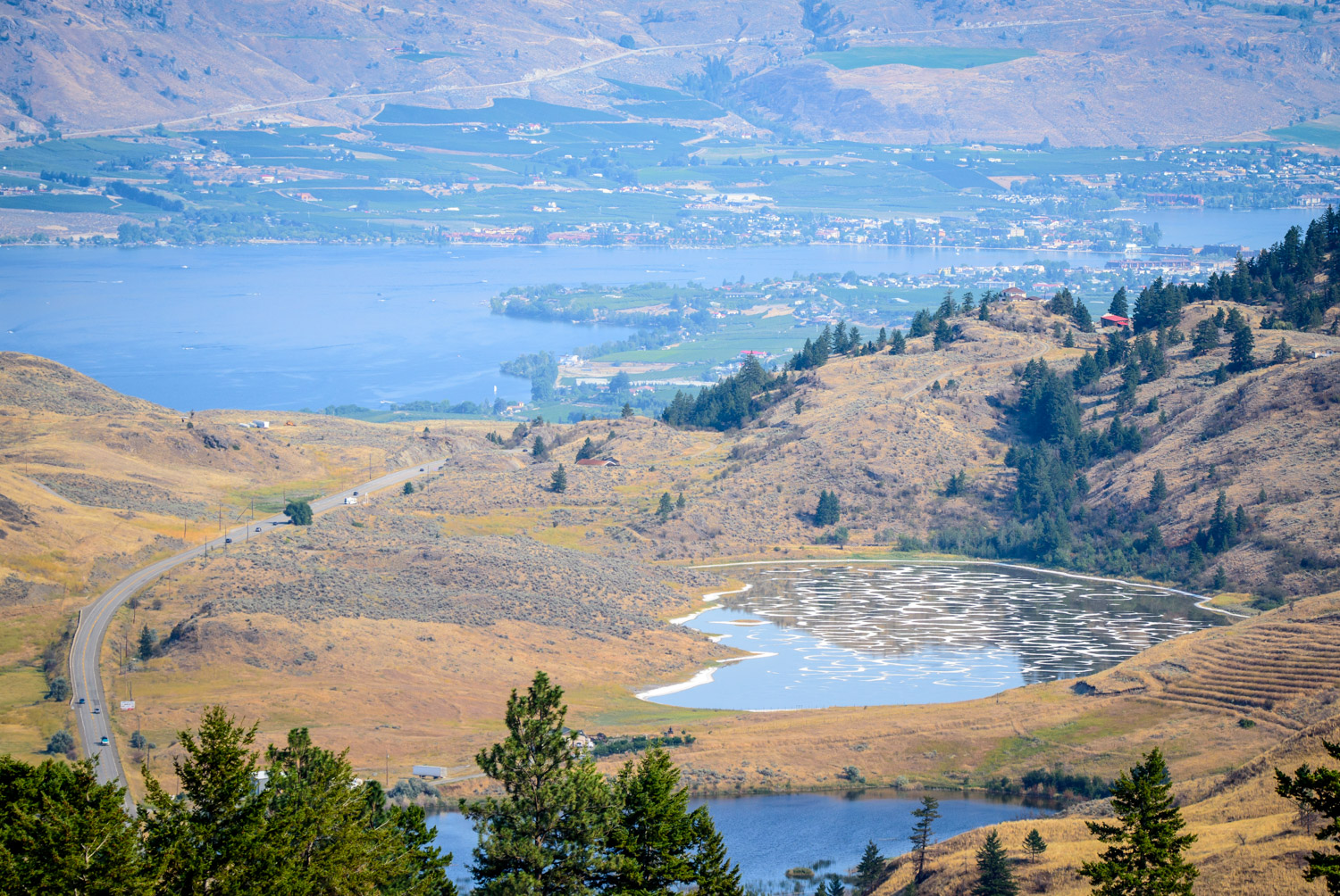
Whenever I need to take my mind off the stresses of work and be surrounded by nature, I take a trip up to Kilpoola Lake to the west of Osoyoos. It’s about 20 minutes away, but it’s like stepping into another world. The road — better described as a “track” — is rough, but the used truck I bought in July is better able to handle it than my car. I took a trip there in late July when water levels were still high from the wet spring, but the effects of drought were starting to take hold. (Richard McGuire photos)


I’ve heard this little lake on the way to Kilpoola referred to as “Turtle Lake,” but I can’t find any official reference to its name, so I don’t know what its real name is. It’s pretty, nonetheless. (Richard McGuire photo)

Up Kruger Mountain road, you come to this little lake, which appears to be an extension of Blue Lake. The landscape is very diverse with forests, grasslands and low mountains. (Richard McGuire photo)

Up Kruger Mountain road, you come to this little lake, which appears to be an extension of Blue Lake. The landscape is very diverse with forests, grasslands and low mountains. (Richard McGuire photo)

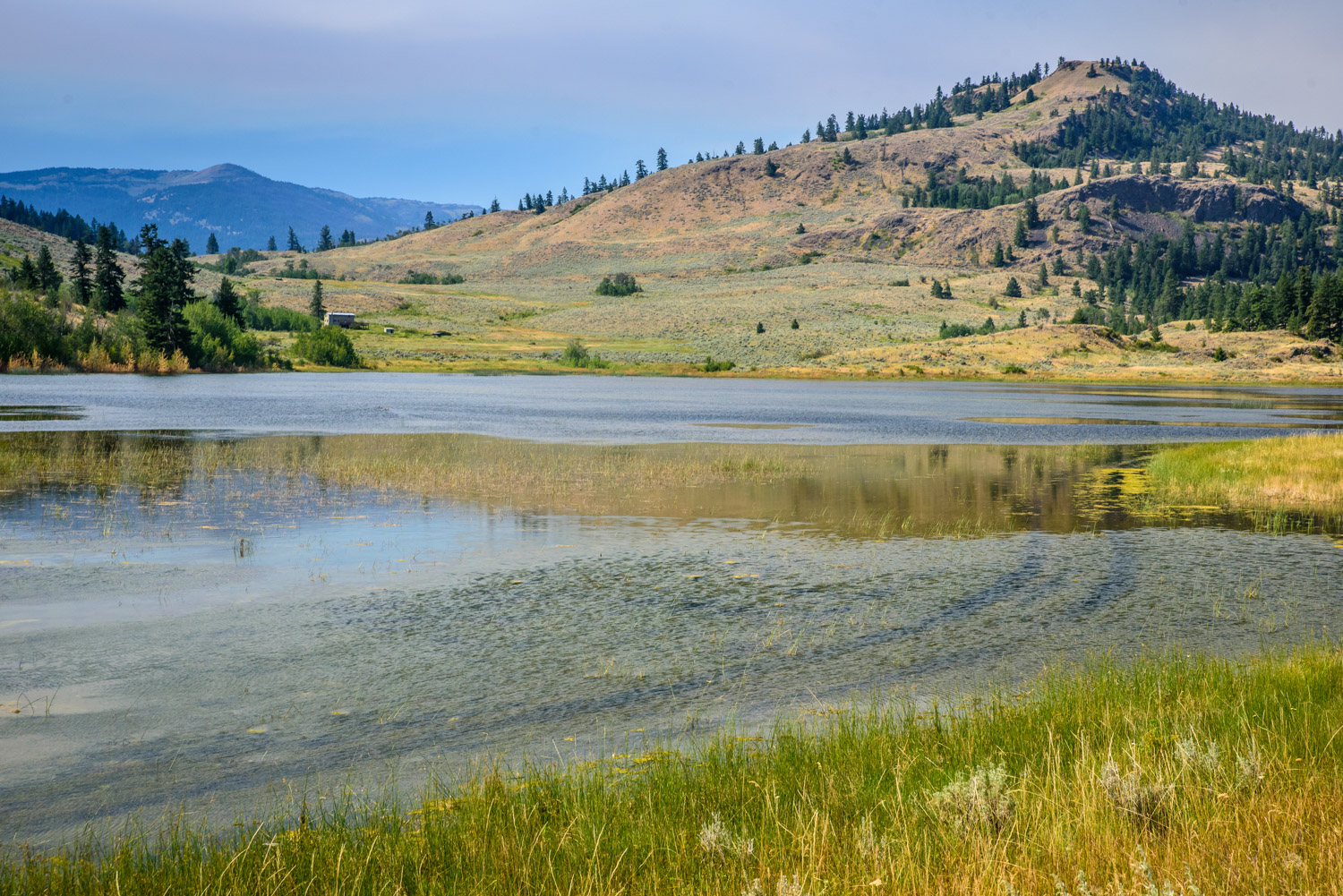
Blue Lake is the largest lake on the way to Kilpoola Lake. It’s set in the midst of forests, grasslands and low mountains. (Richard McGuire photo)

Around Kilpoola Lake, grasslands spread over low mountains with the sweet smell of sagebrush. (Richard McGuire photo)

Around Kilpoola Lake, grasslands spread over low mountains with the sweet smell of sagebrush. (Richard McGuire photo)

A breeze blows through grasses near Kilpoola lake. Although a drought is underway, there’s still a lot of green after the spring flooding. (Richard McGuire photo)

The road past Kilpoola Lake is just a rough track across the grasslands. There was still a lot of green in late July here despite concerns about dry vegetation and the possiblility of fire elsewhere. (Richard McGuire photo)

Around Kilpoola Lake, grasslands spread over low mountains with the sweet smell of sagebrush. (Richard McGuire photo)

Around Kilpoola Lake, grasslands spread over low mountains with the sweet smell of sagebrush. (Richard McGuire photo)

Around Kilpoola Lake, grasslands spread over low mountains with the sweet smell of sagebrush. (Richard McGuire photo)

Flooding in the spring has left the water high in Kilpoola Lake. Even at the end of July, the lower road was still submerged under water, despite widespread drought elsewhere. (Richard McGuire photo)

With higher clearance, the used truck I bought in July was good for travelling on the dirt tracks around Kilpoola Lake. (Richard McGuire photo)

Blue Lake is the largest lake on the way to Kilpoola Lake. It’s set in the midst of forests, grasslands and low mountains. (Richard McGuire photo)

Blue Lake is the largest lake on the way to Kilpoola Lake. It’s set in the midst of forests, grasslands and low mountains. (Richard McGuire photo)