
Near Drumheller, there are rock formations known as hoodoos. Harder stone, often with iron, forms a cap that sits on top of a column of eroding sandstone. At this hoodoo area, a stairway and platforms have been built to provide tourists with a close-up view. (Richard McGuire photo)
I took a quick trip through Alberta this past week when I traveled to Edmonton to trade my aging VW Golf in on a 2008 Jeep Liberty. I much prefer to drive a standard, but they are getting harder and harder to find, which is why the only vehicle I could find that met my needs was in Edmonton. I drove part of the spectacular Icefields Parkway through Banff National Park, stayed at Stony Plain, where I edited a newspaper in the early ’80s, and explored the Badlands between Drumheller and Dinosaur Provincial Park. (Richard McGuire photos)

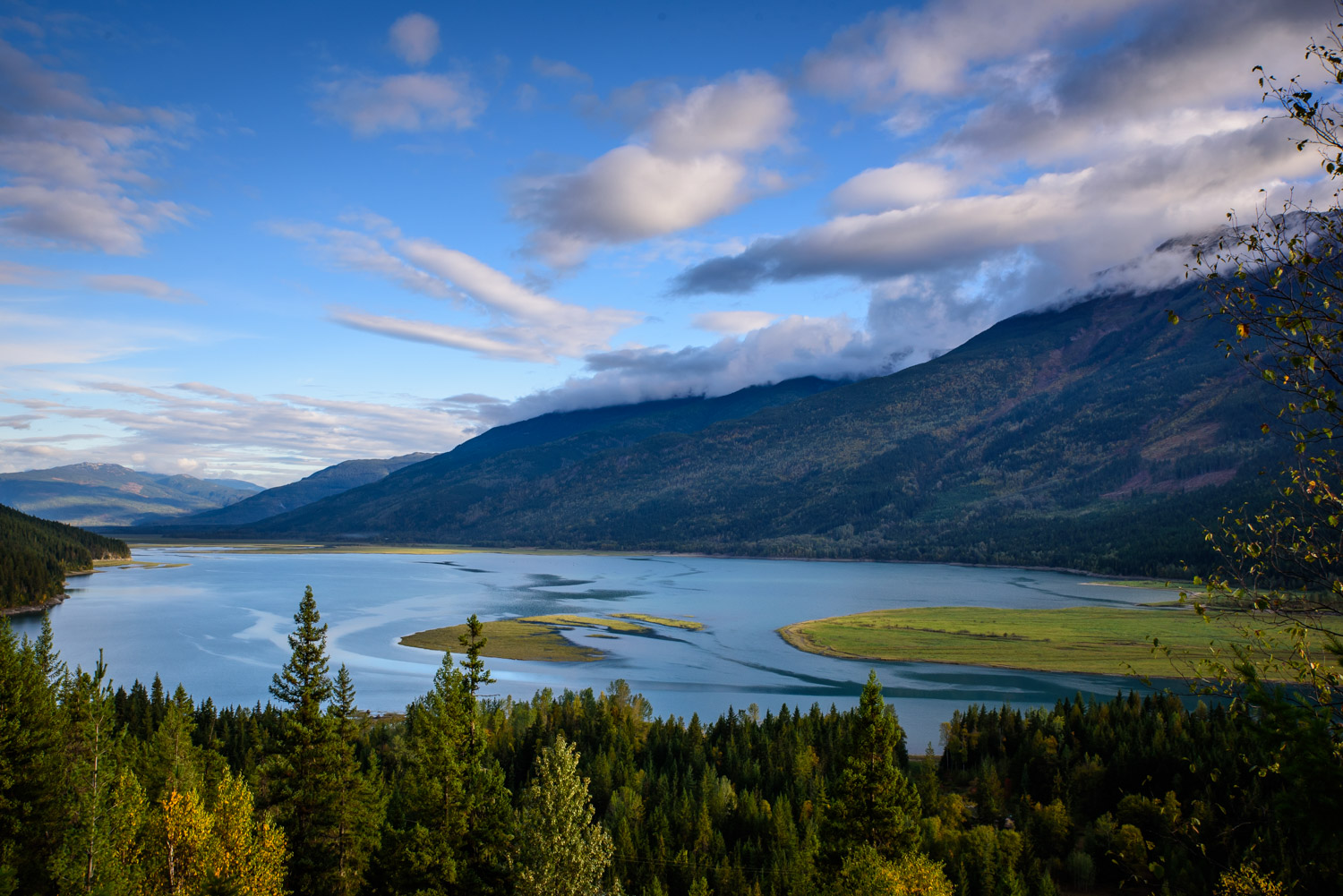


The Columbia River becomes Upper Arrow Lake to the south of Revelstoke, B.C. Along with Lower Arrow Lake, the lake levels were raised by a dam to the south near Castlegar. The morning light made it look beautiful. (Richard McGuire photo)

One of the most beautiful road trips in the world is the Icefields Parkway, which stretches from near Lake Louise in Banff National Park up to Jasper. This shot was taken near Hector Lake close to the south end. (Richard McGuire photo)

Bow Peak rises dramatically to the west of the Icefields Parkway to the west of the Mosquito Creek campground. (Richard McGuire photo)

Bow Peak rises dramatically to the west of the Icefields Parkway to the west of the Mosquito Creek campground. (Richard McGuire photo)

The Crowfoot Glacier near Bow Lake along the Icefields Parkway looks like a chilly place on a cold early October day. As the glacier has retreated over the years, it has lost the lower toe and now looks less like a crow’s foot. (Richard McGuire photo)

Bow Lake, next to the Icefields Parkway in Banff National Park, is the closest lake to the headwaters of the Bow River. It’s lined with steep mountain cliff faces. (Richard McGuire photo)

Bow Lake, next to the Icefields Parkway in Banff National Park, is the closest lake to the headwaters of the Bow River. It’s lined with steep mountain cliff faces. (Richard McGuire photo)

The Saskatchewan River Crossing is where the David Thompson Highway leaves the Icefields Parkway to head east from Banff National Park. The aspens were a brilliant yellow. (Richard McGuire photo)

Abraham Lake is an artificial lake next to the David Thompson Highway heading out of the Rocky Mountains. It is kept full by the Bighorn Dam on the North Saskatchewan River. That storm in the background brought snow flurries. (Richard McGuire photo)

This old abandoned house south of Stony Plain, Alberta, leaves a memory of an earlier era. The area is still farmed, but the houses today are much larger. (Richard McGuire photo)

This rural road south of Stony Plain travels through typical Parkland County landscapes — low, rolling hills, trees and fields, and lots of small lakes. It’s very different from the open prairie. (Richard McGuire photo)

I was the editor of the Stony Plain Reporter in the early 1980s. The building is still there, but it’s now a Community Futures office. A mural on the wall, one in a series of historical murals decorating downtown Stony Plain, shows an early printing press in the days of the Stony Plain Advertiser. (Richard McGuire photo)

When I worked at the Stony Plain Reporter in the early 1980s, we often went for lunch at Bing’s in the Stony Plain Hotel. Both are still there, though much of Stony Plain has completely changed and grown since I lived there. (Richard McGuire photo)

The 1910 Oppertshauser House was faced with demolition in 1984 at a location a few blocks away. Stony Plain had some soon-expiring provincial grant money that could help to save it, but the County of Parkland opted to let its grant money expire rather than put it towards saving the house. “What that house needs is a gallon of coal oil and a match,” said one redneck county councillor. I spoke to the council of Edmonton Beach and they agreed to provide their grant money, thus saving the house. In 1987, it was subsequently moved to a new location next to the Multicultural Centre, the brick former schoolhouse on the left. (Richard McGuire photo)

Heading south from Camrose, there was more and more snow in the fields after a storm that hit the previous night. (Richard McGuire photo)

There’s a gentle roll to the prairies east of Trochu, as the Red Deer River has eroded a valley. That valley widens and evolves into badlands as you travel southeast. (Richard McGuire photo)

The Orkney Viewpoint northwest of Drumheller provides a view of the badlands and the Red Deer River. (Richard McGuire photo)

The Orkney Viewpoint northwest of Drumheller provides a view of the badlands. The prairies suddenly drop off as they hit the Red Deer River Valley. (Richard McGuire photo)

When I bought this used Jeep Liberty in Edmonton two days earlier, they spent a long time detailing it an making it look clean and immaculate. It only took a short bit of driving on a few Alberta backroads and the car was covered with mud. (Richard McGuire photo)

Near Drumheller, there are rock formations known as hoodoos. Harder stone, often with iron, forms a cap that sits on top of a column of eroding sandstone. At this hoodoo area, a stairway and platforms have been built to provide tourists with a close-up view. (Richard McGuire photo)

Near Drumheller, there are rock formations known as hoodoos. Harder stone, often with iron, forms a cap that sits on top of a column of eroding sandstone. At this hoodoo area, a stairway and platforms have been built to provide tourists with a close-up view. (Richard McGuire photo)

Near Drumheller, there are rock formations known as hoodoos. Harder stone, often with iron, forms a cap that sits on top of a column of eroding sandstone. At this hoodoo area, a stairway and platforms have been built to provide tourists with a close-up view. (Richard McGuire photo)

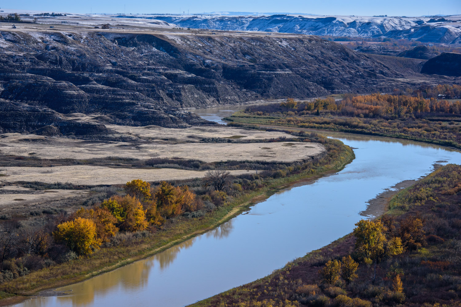
The snowy badlands are reflected in the still waters of the Red Deer River southeast of Drumheller. (Richard McGuire photo)

The remnant of an old grain elevator still stands at Dorothy, Alberta. The small community is a semi-ghost town, which is still inhabited, but has many old derelict buildings recalling its history. (Richard McGuire photo)

When I drove through Southern Alberta the day after an early-October snowstorm, there were still many vehicles in the ditch. Conditions were horrendous during this storm, even for those with vehicles built to handle the rough conditions. When I came along the next afternoon, most of the roads had been cleared except for the odd patch, but many vehicles had not yet been rescued. (Richard McGuire photo)

Dinosaur Provincial Park to the north of Brooks, Alberta, is a great location to see the badlands and walk among the hoodoos. I took a short hike along one of the trails in the early morning, before anyone else arrived. It was peacefully quiet, with only a few deer stirring, and the light was beautiful. Many dinosaur bones have been found at this UNESCO World Heritage Site. (Richard McGuire photo)

Dinosaur Provincial Park to the north of Brooks, Alberta, is a great location to see the badlands and walk among the hoodoos. I took a short hike along one of the trails in the early morning, before anyone else arrived. It was peacefully quiet, with only a few deer stirring, and the light was beautiful. Many dinosaur bones have been found at this UNESCO World Heritage Site. (Richard McGuire photo)

Dinosaur Provincial Park to the north of Brooks, Alberta, is a great location to see the badlands and walk among the hoodoos. I took a short hike along one of the trails in the early morning, before anyone else arrived. It was peacefully quiet, with only a few deer stirring, and the light was beautiful. Many dinosaur bones have been found at this UNESCO World Heritage Site. (Richard McGuire photo)

Dinosaur Provincial Park to the north of Brooks, Alberta, is a great location to see the badlands and walk among the hoodoos. I took a short hike along one of the trails in the early morning, before anyone else arrived. It was peacefully quiet, with only a few deer stirring, and the light was beautiful. Many dinosaur bones have been found at this UNESCO World Heritage Site. (Richard McGuire photo)

Dinosaur Provincial Park to the north of Brooks, Alberta, is a great location to see the badlands and walk among the hoodoos. I took a short hike along one of the trails in the early morning, before anyone else arrived. It was peacefully quiet, with only a few deer stirring, and the light was beautiful. Many dinosaur bones have been found at this UNESCO World Heritage Site. (Richard McGuire photo)

Dinosaur Provincial Park to the north of Brooks, Alberta, is a great location to see the badlands and walk among the hoodoos. I took a short hike along one of the trails in the early morning, before anyone else arrived. It was peacefully quiet, with only a few deer stirring, and the light was beautiful. Many dinosaur bones have been found at this UNESCO World Heritage Site. (Richard McGuire photo)

Dinosaur Provincial Park to the north of Brooks, Alberta, is a great location to see the badlands and walk among the hoodoos. I took a short hike along one of the trails in the early morning, before anyone else arrived. It was peacefully quiet, with only a few deer stirring, and the light was beautiful. Many dinosaur bones have been found at this UNESCO World Heritage Site. (Richard McGuire photo)

Dinosaur Provincial Park to the north of Brooks, Alberta, is a great location to see the badlands and walk among the hoodoos. I took a short hike along one of the trails in the early morning, before anyone else arrived. It was peacefully quiet, with only a few deer stirring, and the light was beautiful. Many dinosaur bones have been found at this UNESCO World Heritage Site. (Richard McGuire photo)

The prairies, near Enchant, Alberta, to the north of Lethbridge are wide open and present a minimalist landscape. The expansive views of the sky form part of the landscape. (Richard McGuire photo)